July 29, 2013
The only significant event today occurred at Fred Meyer
where I found Alaskan King Crab legs for $13.99/lb. They were excellent!
July 30, 2013
The tour left at 0630! After all, it is a 200 mi drive each
way. Our tour guide and driver was Maarit from Haines and did an outstanding
job in both endeavors. Our first break after 2 hours was the Arctic Circle
Trading Post at the “town” of Joy started years ago by the owners. The town is
no more than a collection of house is nearby areas. The outhouses were popular.
Shortly thereafter we entered the Dalton Highway or the pipeline road and
stopped to document that happening.
 |
Arctic Circle Trading Post
|
 |
The Dalton Highway
|
Our second stop was to take pictures of the pipeline, au
naturel. It’s not as bright and shiny as the viewing areas near Fairbanks.
After crossing the Yukon River we stopped at the Yukon River Camp for lunch.
This is a former workers camp for building the pipeline. The Yukon at this
point is nearly ¼ mi wide and 45’ deep and was roaring. Our next major stopping
point was Finger Mountain that has a rock formation shaped like a finger that
points directly towards Fairbanks. Early Bush pilots used it as a navigational
reference. The rocks in this area are
the result of the permafrost pushing the rocks upwards onto the surface.
 |
Pipeline - Note the overhead clearance protection
|
 |
Yukon River - The only bridge across it!
|
 |
Yukon River Camp - good food and reasonable prices, but not fancy.
|
 |
Ice Road Trucker Fans - The Roller Coaster and it is longer and steeper than it looks in this picture.
|
 |
Typical Northern Alaska Countryside. This area was NOT glaciated during the last ice age. It was too dry.
|
 |
Pipeline Zig-zagging
|
 |
Finger Peak
|
 |
View south from Finger Peak - Finger Rock just to the right of pipeline.
|
 |
Finger Rock pointing towards Fairbanks
|
Another push north finally got us to the Arctic Circle. Of
course we had to document our ceremonial crossing of the line. We all got
certificates attesting to this deed. To
celebrate this event our guide gave us all a piece of triple chocolate cake
with whipped cream on it.
 |
Charlie's dash across the finish line!
|
 |
Katherine's Hop
|
 |
Donna! Go ahead step across You won't freeze solid if you do.
|
After heading south again into the sub-arctic we stopped to
see tundra up close and personal. This is not really arctic tundra but alpine
tundra. To get to the true arctic tundra we would have had to drive another 200
miles and cross the Brooks Range of mountains. The tundra grass grows in large
clumps that are definitely ankle breakers if not careful. In between is moss
that is squishy underfoot. The saving grace is the low bush blueberry plants
that were loaded with ripe blueberries for us to pick and snack on. The living
layer of the tundra is only an inch or so thick. Remove a bit of moss, dig out
a big of “muck” and the whole fills immediately with ice cold water. If you
drive on tundra, your tire marks will become permanent mini-lakes that grow
larger each year. We saw evidence of this on the way home.
 |
Tundra blueberries
|

|
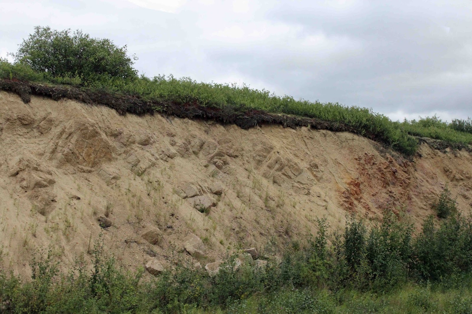
Note the top living layer, that below was once frozen permafrost layer. Now thawed the remnants are dry and powdery will erode away until the living layer again covers it.
|
 |
Alpine tundra
|
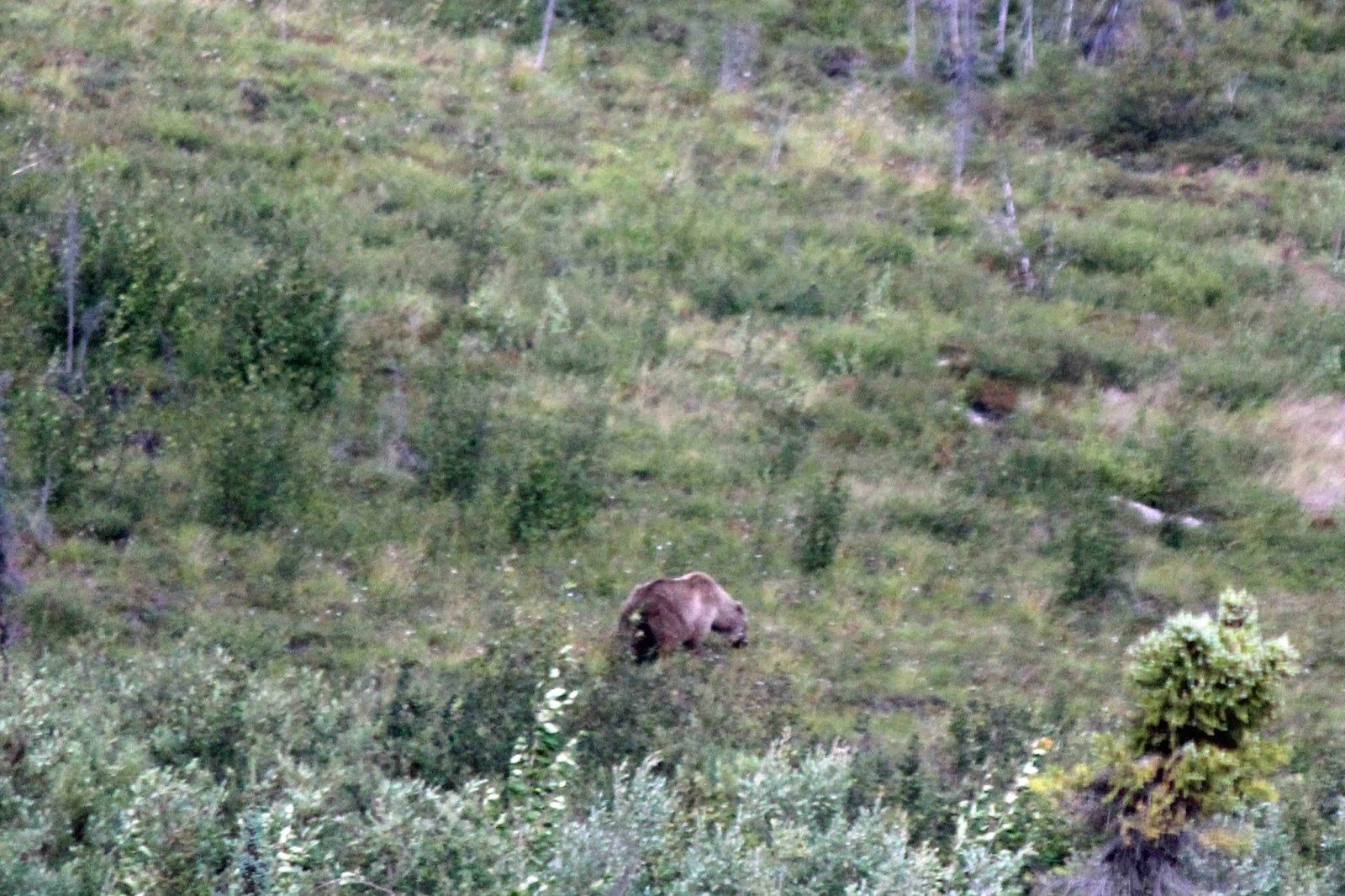
Just after leaving our “tundra stop” someone spotted a bear
about 100 yds. off the road. The pictures I got document it was a grizzly bear.
We again stopped at the Yukon River Camp for our
dinner. The food there is really good and all freshly prepared and cooked.
Katherine had salmon tacos and salmon chowder. We got home about 9:30 PM. Along
but very worthwhile day. I must say I’m glad we did not do this on our own by
car!


No comments:
Post a Comment